Rare 18th century map of Paris

HOMANN, Johann Baptist- Prospect und Grundriss der Weltberühmten Königliche Haupt Stadt Paris samt ihrem Schloß, Universitat und allen herumligenden Vorstadten. Nuremberg, c. 1720. Rare original old-colored engraved map. Size: ca. 62,5 x 54 cm.
EUR 750,-

Rare 18th century map of Paris

Rare 16th century map of Paris

HOGENBERG, Frans; BRAUN, Georg - Lutetia. Köln, 1575. Original Kupferstich aus der französischen Ausgabe von Braun Hogenbergs berühmten Städte-Atlas. Blattmasse: ca. 52 x 41 cm.
EUR 1500,-

Rare 16th century map of Paris

Beautiful world map by Gerard Valk from c. 1690

VALK, Gerard (1651-1726) -"Mappe-Monde Geo-Hydrographique, ou Description Generale du Globe Terrestre et Aquatique en Deux-Plan-Hemispheres ou sont Exactement Remarquées en general toutes les Parties de la Terre et de l'Eau suivant les relations les plus nouvelles". Amsterdam, c. 1690.
EUR 2.900,-

Beautiful world map by Gerard Valk from c. 1690

Souvenirs du Mont-Blanc

CHARLET, A. - Souvenirs du Mont-Blanc. Paris, 1855-1857. Original Leinen-Einband [14,6 x 19 cm]. 23 Farblithographien (14,5 x 18,5 cm), 1 davon doppelseitig (14,5 x 35 cm).
sold/verkauft .

Souvenirs du Mont-Blanc

Constantine Photo Album

LEROUX, Alexandre - Constantine. Algeria, c.1880. Oblong-folio [355 x 470 mm] 18 pages. With 25 large photographs. Original blindstamped cloth with leather spine.
EUR 900,-

Constantine Photo Album

Arctic Voyage

Polarfahrt mit dem D. "Grosser Kurfürst" des Norddeutschen Lloyd vom 27. Juni - 25. Juli 1908. Original-Aufnahmen Atelier Schaul, Hamburg. Album with 73 gelatin silver prints (157 x 222mm). Original red cloth, oblong folio (250 x 355mm)
EUR 1200,-

Arctic Voyage

Rare map of the Philippines

Petrus Bertius (1565-1629) - "Philippinae Insulae". Amsterdam, Hondius, 1618.
EUR 1.500,-

Rare map of the Philippines

Rare series – Twelve Months of the Year

 Isaac Briot (1585-1670) - Die zwölf Monate / The Twelve Months of the Year. Paris, Thomas de Leu, 1610. 12 copper engravings.
EUR 1.800,-

Rare series – Twelve Months of the Year

Beautiful old colored map of the East Indies

MERCATOR, Gerhard (1512-1594) - "Insulae Indiae Orientalis Praecipuae in quibus Moluccae celeberrimae sunt". Amsterdam, Hondius, c. 1606. Approx. 37,5 x 50 cm.
EUR 2.700,-

Beautiful old colored map of the East Indies

Old colored map of Southeast Asia

MERCATOR, Gerhard (1512-1594) - "India Orientalis". Amsterdam, Hondius, c. 1606. Approx. 36 x 49 cm.
EUR 1.900,-

Old colored map of Southeast Asia

Old colored map of Virginia and Florida

MERCATOR, Gerhard (1512-1594) - "Virginiae Item et Floridae America Provinciarum, nova Descriptio". Amsterdam, Hondius, c. 1606. Approx. 34,5 x 50 cm.
EUR 1.900,-

Old colored map of Virginia and Florida

Large wall map of North America

ZATTA, Antonio (1757-1797) - "Le Colonie Unite dell' America Settentr. le Ass. Ee. li signori riformatori dello studio di Padova". Venezia, 1778.
EUR 3.700,-

Large wall map of North America

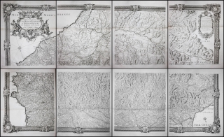
Large map of the Pyrenees

ROUSSEL, Joseph und Francois de la Blottiere - "Carte Generale des Monts Pyrenées et Parie des Royaumes de France et d'Espagne". Paris, 1730.
EUR 2.900,-

Large map of the Pyrenees

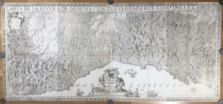
Rare first edition of one of the most important maps of Liguria

CHAFRION, Joseph (1653-1698)- "Carta del la Riviera de Genova con sus verdaderos confines y caminos. / Topographia de la Liguria. Dedicada A L'Excellmo Senor Conde de Melgar del Estado de Milan por D. Joseph Chafrion". Milano, Marc Antonio del Re, 1685.
EUR 4.500,-

Rare first edition of one of the most important maps of Liguria

Map of the American continent

VALK, Gerard (1651-1726) - "L'Amérique septentrionale & méridionale divisée en ses principales parties...". Amsterdam, c. 1700. Size: c. 53 x 61 cm.
EUR 1.800,-

Map of the American continent

Large map of the Hawaii islands

VANCOUVER, George (1750-1798) - "Carte des Iles Sandwich d'apres la reconnoissance qui en a ete faite dans les differentes relaches de la corvette La Decouverte et de sa conserve Le Chatham commandes par le Capt. Vancouver en 1792, 1793 et 1794". Paris, c. 1797. Size: c. 55 x 79 cm.
EUR 1.800,-

Large map of the Hawaii islands

Large map of North America

DELISLE, Guillaume (1675-1726) - "L'Amerique septentrionale". Paris, 1718. Size: c. 54 x 74 cm.
EUR 1.800,-

Large map of North America

 ELWE, Jan Barend (active 1777-1815); JAILLOT, Alexis Hubert (1632-1712) - "Mappe Monde ou Description du Globe Terrestre & Aquatique suivant les dernieres & meilleures". Amsterdam, 1792. Size: ca. 54 x 63 cm.
EUR 1.800,-

Rare large map of Eastern Europe

LOTTER, Tobias Konrad (1717-1777) - "Carte Geographique representant le Theatre de la Guerre entre les Russes, les Turcs..." Augsburg, 1769. Printed on 4 plates. Format: c. 158 x 54 cm.
EUR 1.500,-

Rare large map of Eastern Europe

Rare plan of Sankt Petersburg

Nicolas de Fer (1646-1720) Domenico Trezzini (c.1670-1734); Jean-Baptiste Alexandre le Blond (1679-1719) - "Plan de la Nouvelle Ville de Petersbourg". Paris, 1717. Format: c. 38,5 x 53 cm.
EUR 1.800,-

Rare plan of Sankt Petersburg

Rare large map of North America

CHATELAIN, Henri Abraham (1684-1743) - "Carte Tres Curieuse De La Mer Du Sud Contenant Des Remarques Nouvelles Et Tres Utiles....". Amsterdam, 1720.
EUR 8.500,-

Rare large map of North America

Decorative, highly sought-after rare map of the island of Corfu

SEUTTER, Matthäus - "Nova et exactissima Geographica Delineatio Insulae Corfu seu Corsulae, tanquam..." Augsburg, Seutter. 1741. Platten-Masse ca. 50 x 58 cm. Blatt-Masse ca. 54,5 x 61 cm.
EUR 1250,-

Decorative, highly sought-after rare map of the island of Corfu

Rare 17th century Atlas of the Netherlands

Peers, Richard (1645-1690); Pitt, Moses (fl. 1654-1696) - The English atlas volume IV. Containing the description of the Seventeen Provinces of the Low-Countries, or Netherlands. Oxford, 1682.
EUR 6.500,-

Rare 17th century Atlas of the Netherlands

Very rare 1st edition of Golovnin’s second circumnavigation

GOLOVNIN, Vasily Mikhailovich (1776-1831) - Puteshestvie vokrug svieta po povelieniiu Gosudaria imperatora sovershennoe, na voennom shliupie Kamchatkie, v 1817, 1818 i 1819 godakh, flota kapitanom Golovninym [Voyage around the world by order of His Majesty, the Emperor, on naval sloop Kamchatka in 1817, 1818, and 1819, by Fleet Captain Golovnin] Two volumes. First Edition. Sankt Petersburg, 1822.
EUR 65.000,-

Very rare 1st edition of Golovnin’s second circumnavigation

Rare Atlas of the Baudin expedition to Australia

PERON, Francois Auguste, Charles Lesueur and Nicolas Petit - Voyage de découvertes aux Terres Australes executé par ordre de S.M. l'Empereur et Roi. Partie historique rédigée par M.F. Péron. Atlas par MM. Lesueur et Petit. Paris, (1824). Extremely scarce second edition of this important atlas of the official account of the Baudin voyage to the Pacific. With 25 more plates than the first edition.
EUR 7.500,-

Rare Atlas of the Baudin expedition to Australia

Folio manuscript world atlas by a young lady

CROUZET, Hortense - Atlas Géographique composé de 11 Cartes. Dessiné par Mlle. Hortense Crouzet eleve de l'Institution de Mlle Roullet pour le concours des prix de l'année 1824. France, 1824. Manuscript Title, 11 folded manuscript maps with outline color. 365 x 245 mm.
EUR 1200,-

Folio manuscript world atlas by a young lady
Nach oben