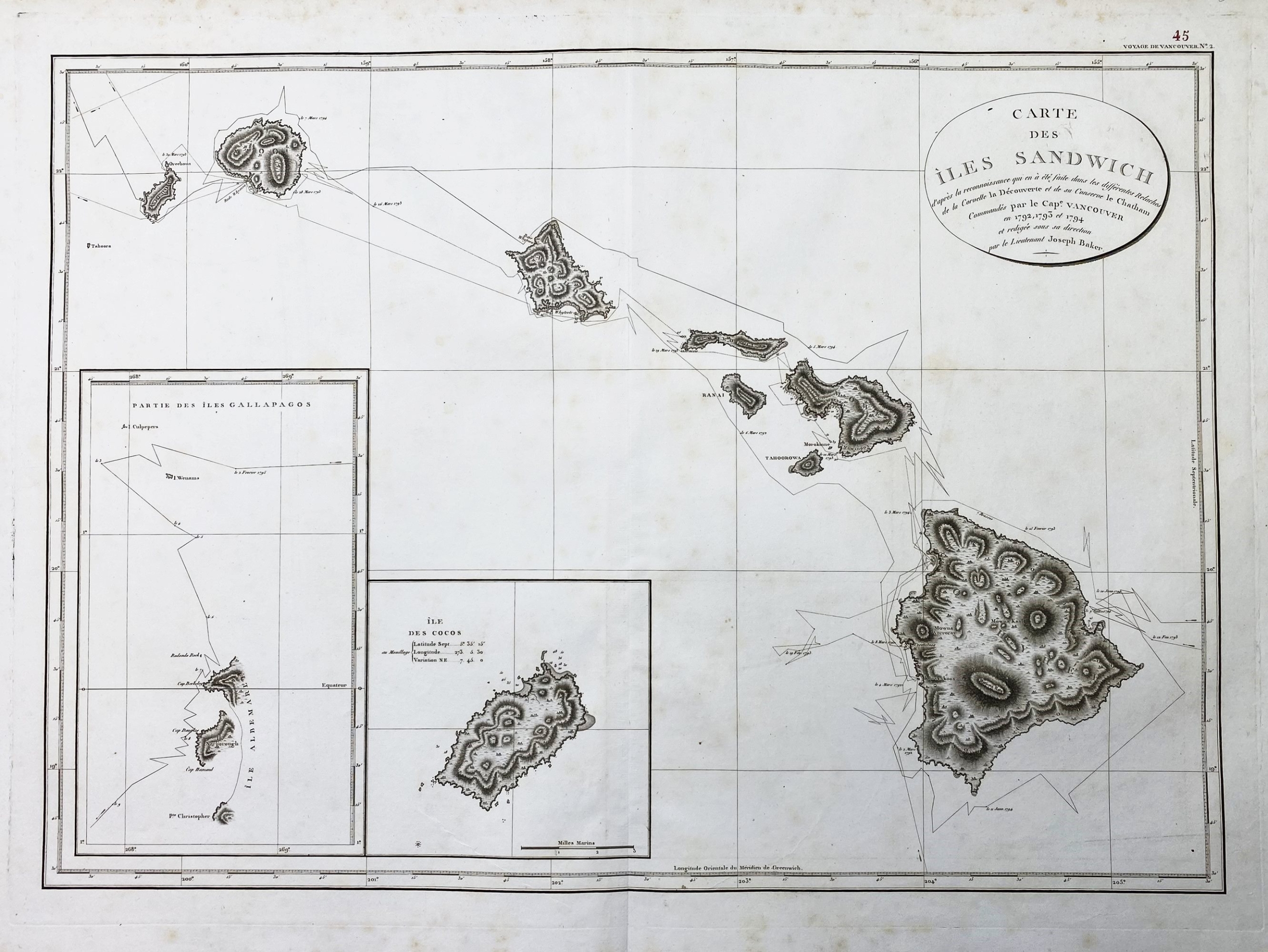
VANCOUVER, George (1750-1798) – „Carte des Iles Sandwich d’apres la reconnoissance qui en a ete faite dans les differentes relaches de la corvette La Decouverte et de sa conserve Le Chatham commandes par le Capt. Vancouver en 1792, 1793 et 1794. „. Paris, c. 1797. Size: ca. 55 x 79 cm.
Very rare and highly important map of the region.
This is an exemplary depiction of George Vancouver’s significant 1799 map of the Hawaiian Islands, renowned as the largest and most important map of Hawaii in the 18th century. Vancouver first encountered Hawaii on January 18, 1778, aboard the HMS Discovery, accompanying Captain James Cook’s HMS Resolution, becoming one of the earliest Europeans to discover the picturesque island group. Despite Cook’s unfortunate encounter with hostile Hawaiian natives, Vancouver formed a positive impression of both the archipelago and its people. Fourteen years later, now commanding his own ship, Vancouver selected the Hawaiian Islands as a winter base while exploring the Northwest Coast of America in search of the Northwest Passage. Over three seasonal visits, Vancouver and his Lieutenant Joseph Baker completed the first comprehensive map of the archipelago, meticulously documenting their route from 1792 to 1794. In contrast to many explorers, Vancouver maintained excellent relations with Hawaii’s indigenous people, introducing useful plants and animals, making significant anthropological observations, and reportedly negotiating a cession of the archipelago to Great Britain in 1794.
Vancouver’s extraordinary mapping of the Hawaiian Islands remained the most advanced cartographic depiction of the region until the late 19th century when the Hawaiian government conducted its own national survey.
EUR 1.800,-