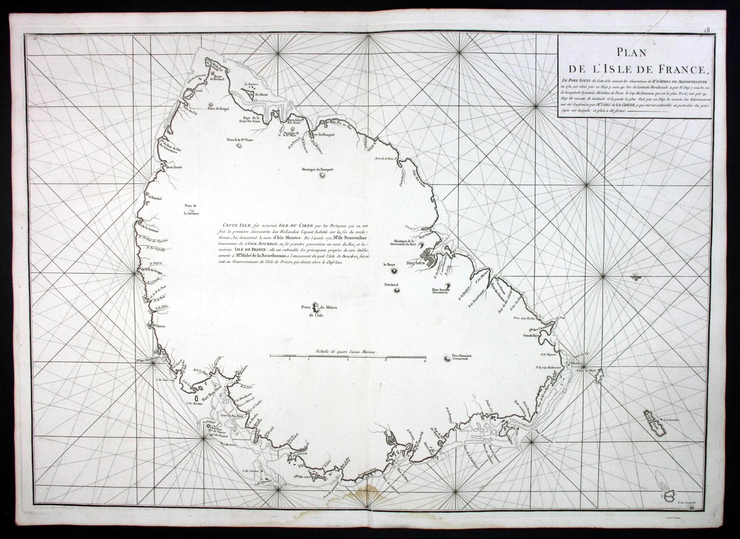
MANNEVILLETTE, Jean Baptiste – Plan de l’Isle de France. Paris, Demonville, 1775.
Seltene original Kupferstich See-Karte nach Mannevillette aus dem See-Atlas „Neptune Oriental“ von 1775 – Blattmasse: ca. 75 x 53 cm – im unteren Rand leicht wasserfleckig, sonst gut erhalten.
Rare original 18th century french nautical chart after Mannevillette out of the sea atlas „Neptune Oriental“ from 1775 – Size of sheet: circa. 29.5 x 20.9 inches. Slightly water stained in bottom margin, otherwise in good condition.
sold