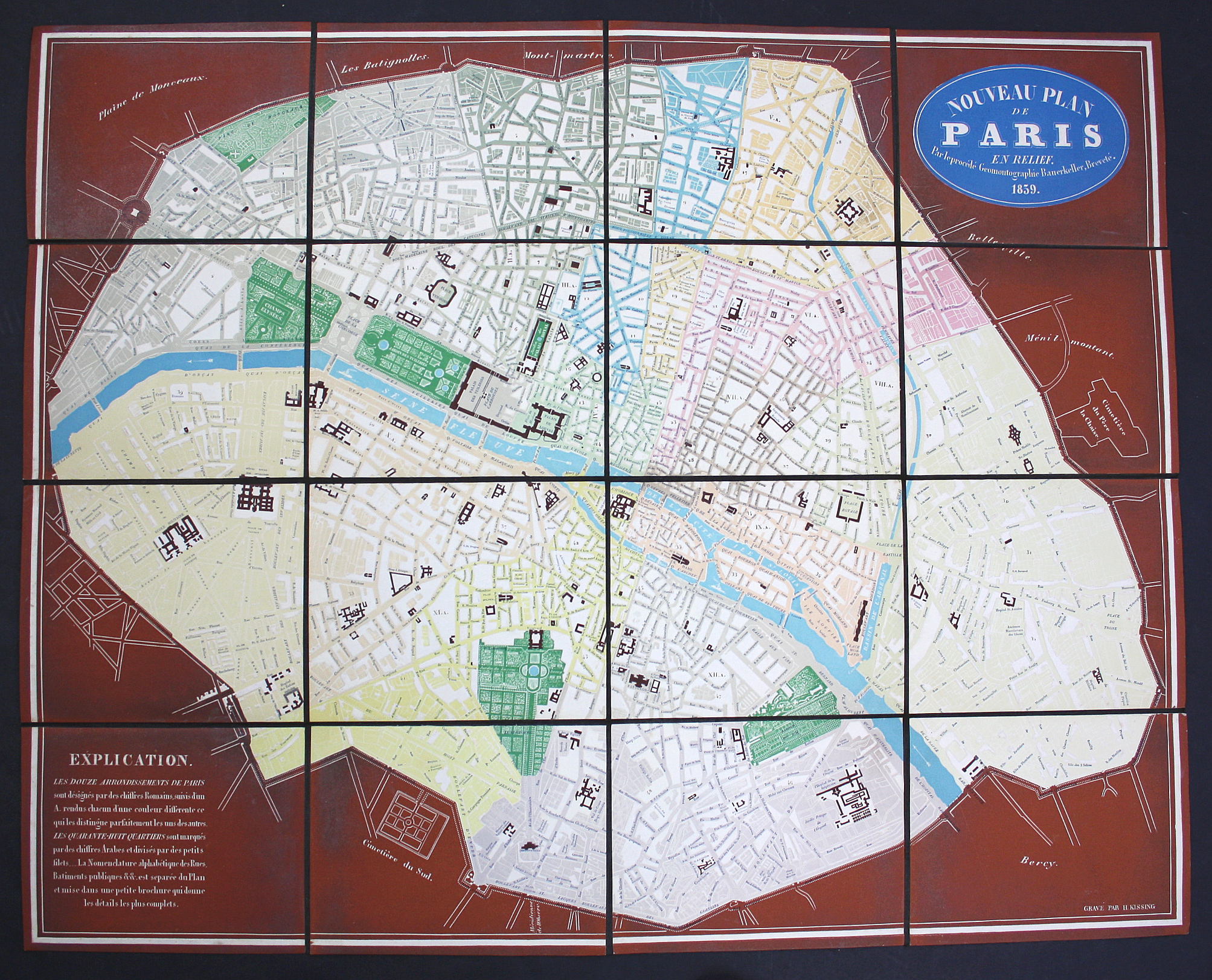
BAUERKELLER, Georg Michael; KISSING, H. – Nouveau Plan de Paris en relief. Par le procédé Geomontographie Bauerkeller, Breveté. Paris, 1839. Size: 554 x 681 mm; 16 sections mounted onlinen. Color lithograph. with slightly later cardboard slipcase.
Very rare first edition of this first relief plan of Paris. Embossed lithographic relief map, with surface raised indicating city blocks. Important public buildings are highlighted in red. Parks are green. The „arrondissements“ in different colours for easy overview. The result makes the map look like a modern piece of art. A very unusual plan. Bauerkeller published similar maps of London, New York, Vienna, Hamburg, Frankfurt and other cities. The Geomontographie-method (a technique to make relief maps such as the present) was patented by Bauerkeller. – Vallée lists only the edition of 1840.
Very good condition.
sold