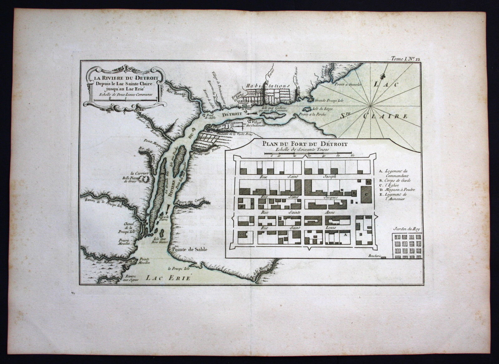
BELLIN, Jacques-Nicolas – La Riviere du Detroit depuis le Lac Sainte Claire jusqu au Lac Erie / Plan du Fort du Detroit. 1764. Rare original handcolored engraved map from Bellin’s „Petit Atlas Maritime“. Size of sheet: ca. 44 x 32 cm (ca. 17.3 x 12.6 inches).
The first printed map of Detroit!
In very good condition
sold/verkauft